![]()
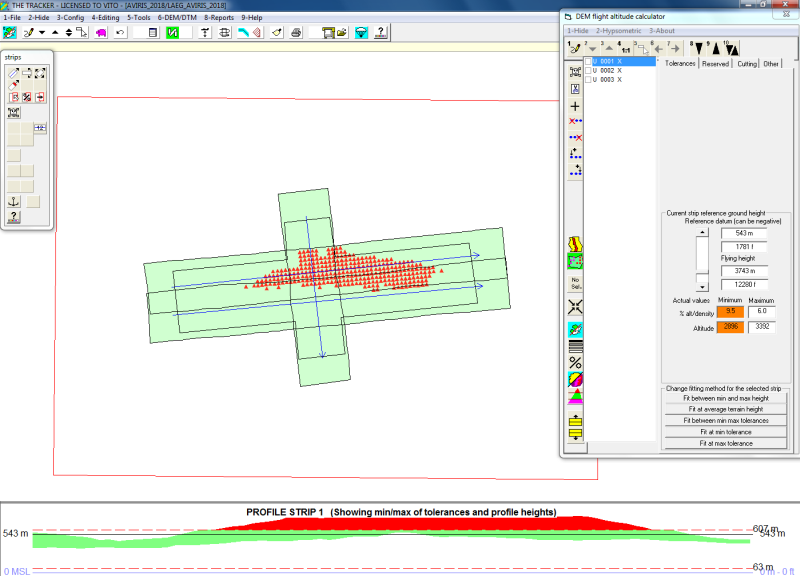
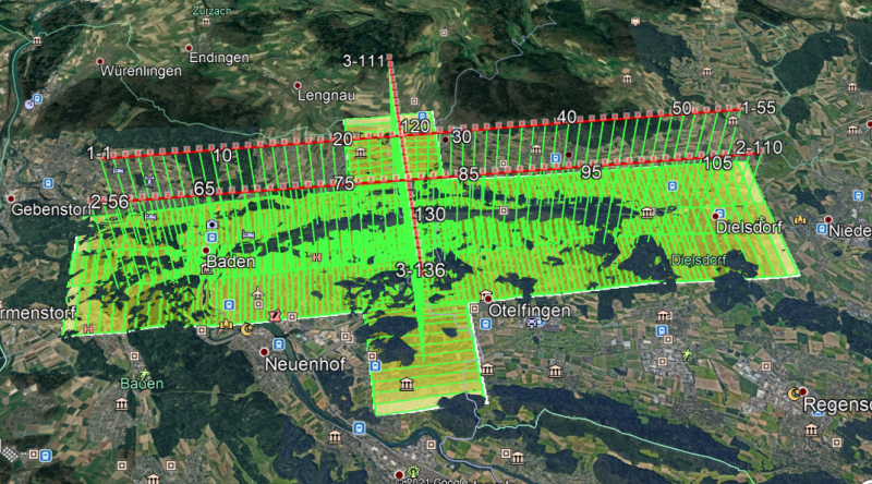
One of the fields of activity of WerfiMatics is planning and coordination of airborne hyperspectral imaging campaigns. This includes the planning of the flight lines to cover the area of interest at a Ground Sampling Distance (GSD)
which suits the research goals on one hand and which suit the available finances of our custommers on the other. Planning the flight lines is a very iterative process, where multiple addaptations are necessary to fully cover the
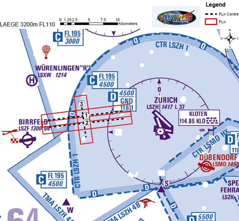
area of interest to full satisfaction. After planning and refining the flight lines, KML or GeoJSON files and maps are generated to compile the mission plan. With these files, the mission flights are coordinated with local Air Traffic
Controll (ATC) and Civil Aviation Authorities (CAA).
Once flight planning is completed and the mission is coordinated with the respective ATC and CAA, the mission is summarized in an Campaign Implementation Plan (CIP). During campaign controlling, this document is used to keep track of
the missions to be flown. Additionally, while the campaign is onging a Data Accquisition Report (DAR) is compiled, which gives a first overview of the accquired data in the campaign.